
Method
How we check facts
Every practical statement on the site has a source and the date we obtained it. For the important things — entry, permits, prices, journey times — we look for a second, independent source; if we cannot find one, or the value changes quickly, we say so: “check for your date”, or we do not publish the value. Climate comes from the ERA5-Land model for 2016–2025, altitudes from a terrain model and published data, and photos from free sources with licences, mostly Wikimedia Commons.
Updated 13 October 2026
- Source and datefor every practical fact
- 10 yearsERA5-Land climate, 2016–2025
- −6,5 °Cfor every 1,000 m of climb
- Photo creditsa separate page for each place
Checking
How a fact is checked
We do not retell a single guidebook. Every statement is tied to where it comes from.
- Source
- A practical statement needs at least one source with the date we obtained it: an official page, a legal act, an operator’s timetable, a map, a scientific database. We keep copies of the responses.
- Two independent sources
- For the important things — visas, permits, prices, journey times, safety — we look for a second source unrelated to the first: an official text and an independent report, or two different providers. We do not always find one; then the fact gets the label described below.
- Date of checking
- Under the page heading is an “Updated” date. It is the date when we last checked the page, not the date of changes on the ground.
- If sources disagree
- We do not take an average. We keep the value we can confirm, and in doubtful cases we do not publish a value at all.
- Re-checking
- Some entries are checked by a separate person who did not write the text. The checks are made on a sample, not on everything; the comments and the result are kept.
What the labels mean
“Check for your date” and gaps
- Check for your date
- The value changes or depends on your passport, the provider or the season: prices, timetables, opening hours, entry rules. We show the last confirmed value; before you travel, check it with the provider or an official source. check for your date
- If there is no answer
- We did not find a reliable answer. We do not invent a number or put in “about”: we do not show such a line or block on the page.
- The ≈ sign
- An approximate value: an estimate, not a measurement. Journey times and straight-line distances, for example, are written this way.
Temperature
Where the climate comes from and how temperature is calculated
- Source
- The ERA5-Land model, a reanalysis from the Copernicus service of the European Centre for Medium-Range Weather Forecasts. We obtain the data through the open Open-Meteo archive.
- What we show
- For each month: the average daily maximum and the average night-time minimum for 2016–2025, that is, over 10 years and 3,653 days, rounded to the nearest degree.
- This is the norm, not a forecast
- The figures show what a month is like on average. The weather on a particular day can differ markedly, especially on passes and near glaciers.
- Size of the model cell
- The ERA5-Land grid is about 9–11 km. For narrow valleys and passes the values are smoothed, and the model takes the altitude of a cell from its own terrain model.
- Temperature at the place
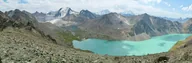
- If a place can be reliably tied to a coordinate, we calculate the temperature at that point. For example, Lake Ala-Kol and Karakol are shown on two different lines.
- Altitude correction
- Along a route with no point of its own, we take the climate of the base (for example, Karakol) and apply a correction: for every 1,000 m above the base the temperature is 6.5 °C lower, and below the base it is higher by the same amount. This is an average rule for the free atmosphere, not a measurement: wind, sun and night-time swings in the mountains change how it feels.
- When we do not show climate
- If the point of a place cannot be reliably tied to a coordinate, we do not show the climate of the place and do not substitute the weather of a neighbouring town.
- Date obtained
- The data was obtained in September and October 2026.
Where it is and how high
Altitudes, coordinates and maps
- Coordinates
- Taken from OpenStreetMap and Wikidata and checked against descriptions from official sources and providers. If the coordinates from two sources differ by more than 2 km, the point is treated as unconfirmed until we sort it out.
- Altitudes of points
- From a digital terrain model (through Open-Meteo). If a lake, pass or city has a published altitude, we show that and keep the model’s altitude separately: they can differ.
- Route profile
- We calculate altitudes along a line from raster terrain tiles (Terrarium, level 13) at 100 m intervals. Elevation gain and loss are calculated from this profile.
- Lines and maps
- Lines of roads and paths come from OpenStreetMap, and the maps carry the © OpenStreetMap credit. The maps on the site are diagrams for orientation, not navigation tracks: for a hike you need a separate map and up-to-date information about the trail.
Images
Photos and licences
- Where the photos come from
- Mostly from Wikimedia Commons: every file there has an author and a free licence. Some pictures come from Flickr, where the author chose a free Creative Commons licence.
- Licences
- We use CC BY, CC BY-SA, CC0 and public domain. We save the licence and the file page when selecting; we do not take pictures without a free licence.
- The “Photo credits” pages
- Every place has a credits page: the title of the picture, the date it was taken, the author, the licence, a link to the file page and a note on changes. Example: photo credits for Song-Kol.
- What we change
- We reduce photos in size and convert them to WebP. Sometimes we change the season or the light to show a place in a month for which there are no free pictures. Such images are labelled “modified” or “image prepared”, and the credits page names the original file.
- People in photos
- We choose pictures in which people are not the main subject. If you recognise yourself and want a picture removed, write to us.
Feedback
How to report a mistake
- What to write
- The page address, exactly what is wrong and what supports it: a link to an official source, a date, a photo of a sign or a ticket.
- Where
- To hello@kyrgyzseasons.com. We do not promise a reply time.
- What happens next
- We will check the message under the same rules. If it is confirmed, we correct the text and the “Updated” date; if we cannot confirm it, we mark it “check for your date” or remove the value.